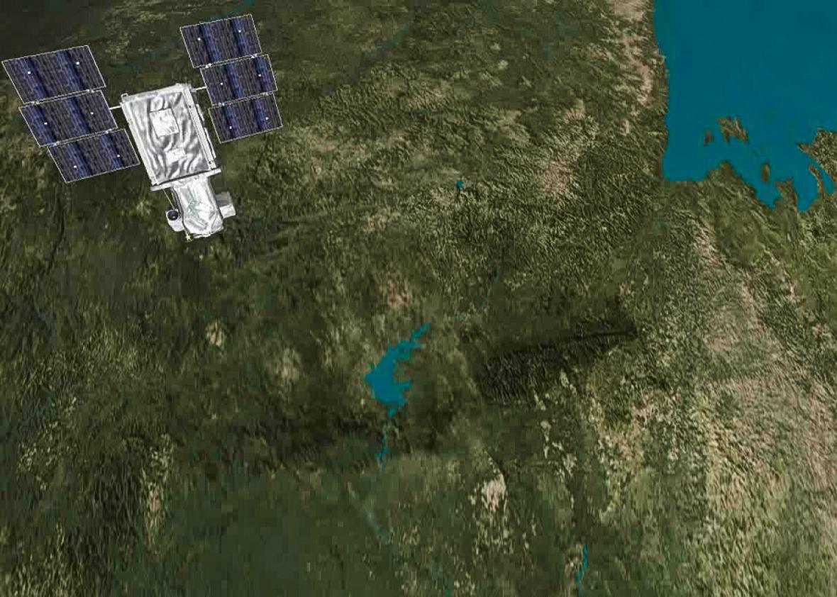
When Elon Musk’s SpaceX rocket exploded over Cape Canaveral, Florida, June 28, its entire payload of supplies to the International Space Station was destroyed. Also lost were the eight tiny satellites owned by Planet Labs—a self-styled agile space company with ambitions to provide a high-resolution picture of the entire planet every day for at least the next 20 years.
Planet Labs’ founders say they’re part of both a blossoming ecosystem of space industry startups and an ongoing revolution in electronics and sensing. That ecosystem meant that the massive SpaceX failure didn’t spell ruin for Planet Labs. It was able to get 14 new satellites into space less than 60 days after the explosion—a recovery time unthinkable in the previous era.
Planet Labs’ rapid recovery is indicative of a new technological trend in a rather unexpected field. This generation of remote sensors—which can be quickly produced, deployed, and adjusted—will power new opportunities for journalism. Indeed, the most innovative practitioners are already honing their skills to use satellites’ data and imagery. But although the new space-startup ecology gives Planet Labs an astounding resilience and has some newsrooms excited, these developments have also sent policymakers, ethicists, and lawyers scrambling to catch up.
A startling number of sensors now permeate our world, from the accelerometers in Fitbits to the motion sensors in autonomous cars. The powerful instruments on high-flying drones and satellites are called “remote sensors”: high above, rarely noticed, but immensely powerful, particularly when it comes to documenting change. For ProPublica journalists telling a story about the devastating land loss in Louisiana, remote-sensing data opened up particularly important storytelling capabilities. Traditional editors and journalism professors say that stories need characters and anecdotes; they’re the color that attracts readers and evokes a passionate response. But some stories spread over decades and miles—individuals and anecdotes alone can’t show that. Al Shaw, from ProPublica’s data team, had read that the Louisiana coast loses a football field’s worth of land every hour. “I wanted people to see the maps and the scope of the problems,” he said.
The team, with considerable help from the U.S. Geological Survey, drew on a remote-sensing data that started with NASA’s first Landsat satellite in 1972 and ended with the current Landsat 8. ProPublica’s work presented an environmental problem that could be uniquely illustrated by images collected with the widest of views—from outer space—over the course of decades. Satellites don’t get bored returning to the same subject year after year. The data they generate allows for excellent visualizations, which online readers enjoy interacting with.
Satellites’ remarkable access makes them particularly valuable for those reporting on hostile regions. Within hours of the Aug. 12 chemical warehouse explosion in Tianjin, China, the New York Times had published before and after satellite imagery of the site of the disaster. Bypassing the monitoring that Chinese authorities place on foreign journalists, the Times could use satellite imagery from one of the private industry leaders, DigitalGlobe, to show detailed images and diagrams of the hazardous materials storage. One of the newsroom’s cartographers and satellite experts, Derek Watkins, says they’ve found that government satellites like Landsat rarely have the spatial resolution to show news events.*
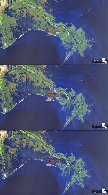
Screenshot from Propublica*
News organizations famously lost exclusivity on information distribution years ago, but the increasing availability of satellite imagery might also be eroding big news companies’ other competitive advantage: a far-flung network of foreign correspondents. Satellites can be thought of as reporting tools with great international access and superhuman capabilities, and the private operating companies will provide the content to all comers (as long as they’re able to pay). On Aug. 31, the U.N. satellite analysis unit broke news on Twitter confirming that ISIS had razed to the ground the main temple in the ancient city of Palmyra, Syria. The BBC picked up the story shortly thereafter.
In these examples satellite imagery mostly helped journalists tell stories they were already reporting, but executives at new space companies have also placed bets that combinations of technology trends will be transformative; cheaper crafts and more powerful sensors, coupled with computer vision and algorithmic signal detection, may give researchers wholly fresh leads or new predictive abilities. Planet Labs co-founder Robbie Schingler’s goal is to get 150 shoebox-size satellites into a constellation around Earth, taking a 3- to 5-megapixel-resolution image of the whole planet every single day, and, over time, producing a visual archive lasting 20 years or more. The ex-NASA staffer invokes the missions of librarians and scholars: “That longitudinal data of 20 years is history. It’s history that’s actually recorded.” And here, his goals start to sound very similar to those of the fourth estate: “You may be able to classify the decisions that people make earlier; say, a land use policy, where you can say, ‘Probabilistically, if you vote this way, this is going to happen.’ That’s what could happen if we enable the transparent planet.”
The U.S. government only recently started licensing satellite companies to sell very high-resolution images to private customers. So whereas Planet Labs intends to take medium-resolution images of the whole Earth every single day for years, some of its competitors, like DigitalGlobe, took advantage of the U.S. government’s looser restrictions on spatial resolution. They post 12-inch resolution images—around 50 times more precise than the U.S. government’s Landsat images, the resource freely available to journalists and the public. Viewers of DigitalGlobe’s imagery can pick out branches on trees, individual windows, and car panels. (Clients who want fresh imagery can order up a mission, sending the satellite and its giant camera lens to their point of interest.) Amnesty International has used DigitalGlobe’s infrared imagery to analyze Boko Haram’s mass killing and destruction in Nigeria.
At this level of spatial resolution, privacy and surveillance considerations come into play. Satellites tend to escape the fear and aggression directed toward camera-equipped drones—maybe it’s out of sight, out of mind. But many of the same threats to the social contract apply. Depending on your perspective and the actions of the operators, these remote-sensing technologies can transcend human limitations (a god’s-eye view, never tiring, never getting bored, watching wherever needed) or exacerbate human vulnerability. (Consent is not sought, nor are the watchers themselves seen.)
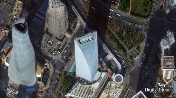
Image courtesy DigitalGlobe
Privacy advocates, lawyers, and ethicists have picked out the places where this fast-moving field has outpaced established codes. University of Mississippi space law professor Joanne Gabrynowicz says the laws around remote sensing need to be completely rewritten. The control technologies that once took up whole buildings, theoretically subject to security audits, can now run on laptops. The marketplaces can be international, and the ’90s optical sensors have been supplemented with new technologies like 3-D modeling. According to Gabrynowicz, all these technical changes and international stakeholders challenge the language and the spirit of existing legislation. But even if one leaves the precision of laws aside, some fundamental ideas about the “right to be let alone,” or the ability to control information about you, have been eroded. Satellites’ paths and operations are even less transparent than surveillance drones. Ethicists recommend that data collectors act with restraint, transparency, accountability, and clearly defined goals, but that is at odds with the opportunities provided by having a detailed, wide-ranging record of the earth’s physical status.
Perhaps one forward path comes from the idea of the “ground-truth,” a concept articulated by remote-sensing expert Lela Prashad. Satellite sensing gives valuable data but provides an incomplete picture—visually and otherwise. The remote operator can’t benefit from the nuances of face-to-face conversations, nor do people on the ground have the chance to guide researchers to new information. As Prashad has written, “Remote sensing imagery must be integrated with other ground-truthed data, local knowledge, and a firm understanding of people and communities to pull together a full story.”
The original space race was a competition between the great national powers of the late 20th century. It’s fitting for the current era, somehow, that this decade’s new space race is globalized, extraordinarily venture-capitalized, and utterly imbued with the information age’s hopes and fears. Journalists, researchers, and storytellers are getting an astounding new set of digital sources, but the ability to use them well will depend on humanity as much as technique.
*Correction, Sept. 18, 2015:This piece originally misidentified Derek Watkins as the New York Times’ cartographer and satellite expert. Several people at the Times newsroom are cartographers and satellite experts. Also, due to a production error, an image was incorrectly credited to DigitalGlobe. It was a screenshot from a ProPublica story.